Navigating
There are basically two parts to Bahrain: the north end, about 10 miles square, is occupied by Manama, some very pretty suburbs (with lots of flowers and palm trees) and a few villages. The remaining two-thirds of the island is basically desert. Navigating through each of these sections provides its own challenges.
I received the company car I was to use from a colleague who had invited me to his house near the stadium to pick it up. This meant that I first got behind the wheel after dark.
I set out to find my way home. I knew I would make it eventually. Yes, it was now dark, so I had no sense of direction. Yes, the map I was using was sort of approximate in its scale and representation of streets, (which it cleverly neglected to label). But I knew I would make it, since I always do. Ah, I am on Amman Boulevard! Now, where in the @#$% is that? Hello? The stadium? Again?

And then in a place that seemed to be called Isa Town the boulevard turned into a small street, which turned into an alley before becoming a dirt road. There were no street lights in the dirt road neighborhood, so it was really dark! And I was surrounded by women completely covered in black Ė face and all. And there were a lot of cats. Herds of cats. Flocks of cats. Prides of cats! And it was really dark! Kind of spooky. But I knew I would make it, since I always do.
Then there is this cute bit of Russian Roulette with the traffic circles: pick an exit and then later, a hundred yards down the road a sign tells you what you chose. If you guessed wrong, there are no breaks in the median strips for another kilometer or so, where you get to negotiate the next traffic circle. I really was convinced that I would make it home Ė eventually. (Thereís the stadium?! AGAIN?!) I always do.
Did I mention that Bahrainis arenít really trained in maps? The idea that the lines on a piece of paper represent the streets in the world isnít part of their culture. I would stop and show someone my map and ask him to tell me where on the map I was. He usually didnít know.
Later, on the weekend, I drove the length and breadth of the island. Unfortunately I drove the breadth when I thought I was driving the length and vice versa. But I had a good time.
I headed south, and found a traffic circle in Alawi where the exit that I thought was the continuation of the highway I was on, turned out to be a small street with a guard. As it happens, he was just watching everyone who entered the town and didnít give me any trouble. But when I got into town, the road that should have taken me south ended abruptly in the middle of a neighborhood. Hmm. Where have I gone wrong? I found a travel agent who gave me (sort of) directions, but then I found myself on the Zallaq Highway. I couldnít find Zallaq on my map, but I figured, what the Hell, letís see where this goes. I thought I was going south Ė until I saw the sign for the beach. Oh. (Beaches are on the west coast.) So I looked again and sure enough there was the town of Zallaq ó on the west coast. Oh, well. I wanted to go to the beach anyway.
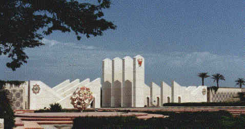
(An interesting looking neighborhood was here. The architecture at its entrance was very exciting.)

This story actually gets much longer and more complicated, but I think you get the idea.
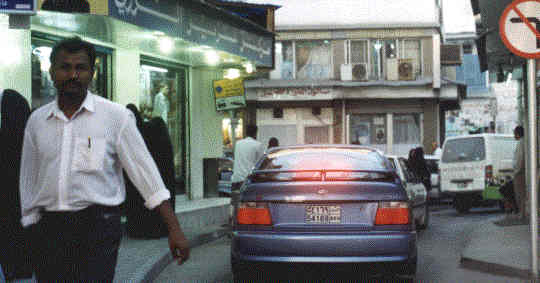
By the following weekend I actually had the countryside pretty well mastered. The city was another story. Once when I was driving through Manama, I wound up in what I would call the "Souq funnel". This is at the point were one-way streets give you no option but to drive into the heart of the market, with its narrow streets and fabric booths.

To give you an idea of the experience, imagine walls on either side of the sidewalk on New Yorkís Fifth Avenue. Now, narrow it until it is only slightly wider than your car. And give it a ninety-degree bend every fifty yards or so. Keeping all the people there, now try to drive through it. Thatís the idea. It is an unbelievable maze. It was sort of entertaining, but . . .
I think the expression "inshallah" (if God is willing) was invented by Bahraini pedestrians. They are completely oblivious to cars. Now, Bahraini drivers, on the other hand, have a completely different attitude. If you are driving the speed limit in the left lane, you will hear about it.
I have been having great fun trying to learn local names. I find mnemonics help. For example, the main north-south highway (the one that ends abruptly in Awali) is officially called the Shaikh Salman Highway. I simply remember it as Salmon Rusdie Boulevard. And Al Sulmaniya Avenue will for me always be Salmonella Avenue.
Last week, I finally found a real map! What a joy! The streets and highways were drawn to scale. The major roads were all labeled. INFORMATION IS POWER!
The Production Planning Manager in my client company is a kind fellow from the north of England. I had had enlargements made of some of the pictures I took here, and he offered to help me get them framed at a shop he knows in the souq. We were to go last night, but I had to work late, so today he offered to have the company driver take the pictures into town. I handed them over and he promised they would be ready this afternoon.
I left him and then I got to thinking. Whatís wrong with this transaction? So I went back to Bill and I asked him. Did the driver know where the shop was?
Well, no.
Ok, then pray tell, how exactly did you give him directions? How can you describe the location of any shop in that morass? There are no street names, and certainly no addresses.
Oh, that was easy. The driver knows where the Darjeeling store is. The manager there is a friend of Billís. So the driver was to deliver the pictures to the Darjeeling store, Bill would then call his friend, and direct him to take them down the street and around the corner to the framing shop. Bill would then call the framing store with instructions. When the job was done, the frame maker would return the pictures to the Darjeeling store, where the driver would then pick them up.
No problem, right?